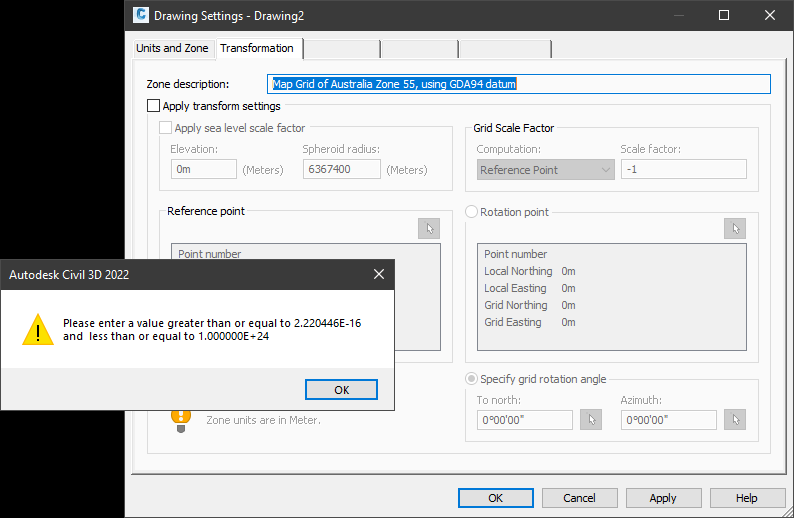
Problem:
When you try to edit the Civil 3D Drawing Settings, the following message appears and you are unable to make changes or save the settings.

Issue:
Civil 3D has a conflict with drawings (or templates) created in older versions of Civil 3D (2018 or earlier) which contain an assigned coordinate system based on the GDA94 datum.
The recent changes to the Australian Height Datum (GDA2020) are incorporated in Civil 3D but are not compatible with the ‘old’ definition of the GDA94 coordinate system. The old coordinate data in your file must be purged and re-assigned.
Solution:

The process is:
- Open your drawing or template in Civil 3D
- Click on Remove Location from the Geolocation ribbon panel. (Alternatively run GEOREMOVE at the command line)
- Click Yes to confirm
- Assign a coordinate system as required (i.e. MGA-55 etc.). Click Edit Drawing Settings from the right click menu after selecting the drawing name in the Settings
tab of the Toolspace. - Apply the changes and close the Drawing Settings dialog.
- Save the file.
You will need to follow this process on all drawing files that have the same issue.
It is strongly recommended that you review your drawing template for this potential issue.
For further information, refer to the Autodesk article:
Changes to Australian Coordinate Systems for GDA2020